Hartlepool Sports & Leisure
Hartlepool Transport
A Potted History Of Hartlepool
Hartlepool Trade & Industry
Hartlepool Health & Education
Hartlepool People
Hartlepool Places
Hartlepool at War
Hartlepool Ships & Shipping

Related items :
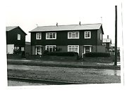
 Easington Road/Powlett Road roundabout 1949
 Donated by Robert Wood Collection
Part of the Hartlepool Museum Service collection
Dated 1949
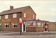
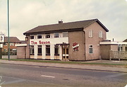
The Saxon 2014
 Created by Don Stephenson
Donated by Don Stephenson
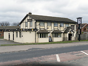
Created by Don Stephenson
Donated by Don StephensonPart of the Hartlepool Public Houses collection